I have gone on several hikes with Bella around Arabia Mountain. She loves the adventure and I liked getting some exercise and seeing new places around Atlanta. Yesterday was supposed to be reasonably warm whereas it would be in the 30’s most of the rest of the week, so I decided that was the best day for a hike. I have done two good 3 mile hikes at Arabia twice each, so I wanted to try something new. I looked up the trails at Sope Creek in Cobb County and found a good loop about 3 miles long, which seems like a good length for both of us.
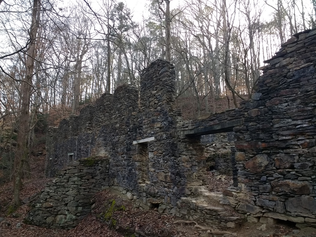
I had never been there, but I knew there used to be a covered bridge over Sope Creek and I think at least one of the stone supports is still there, though the bridge itself burned down in 1964. 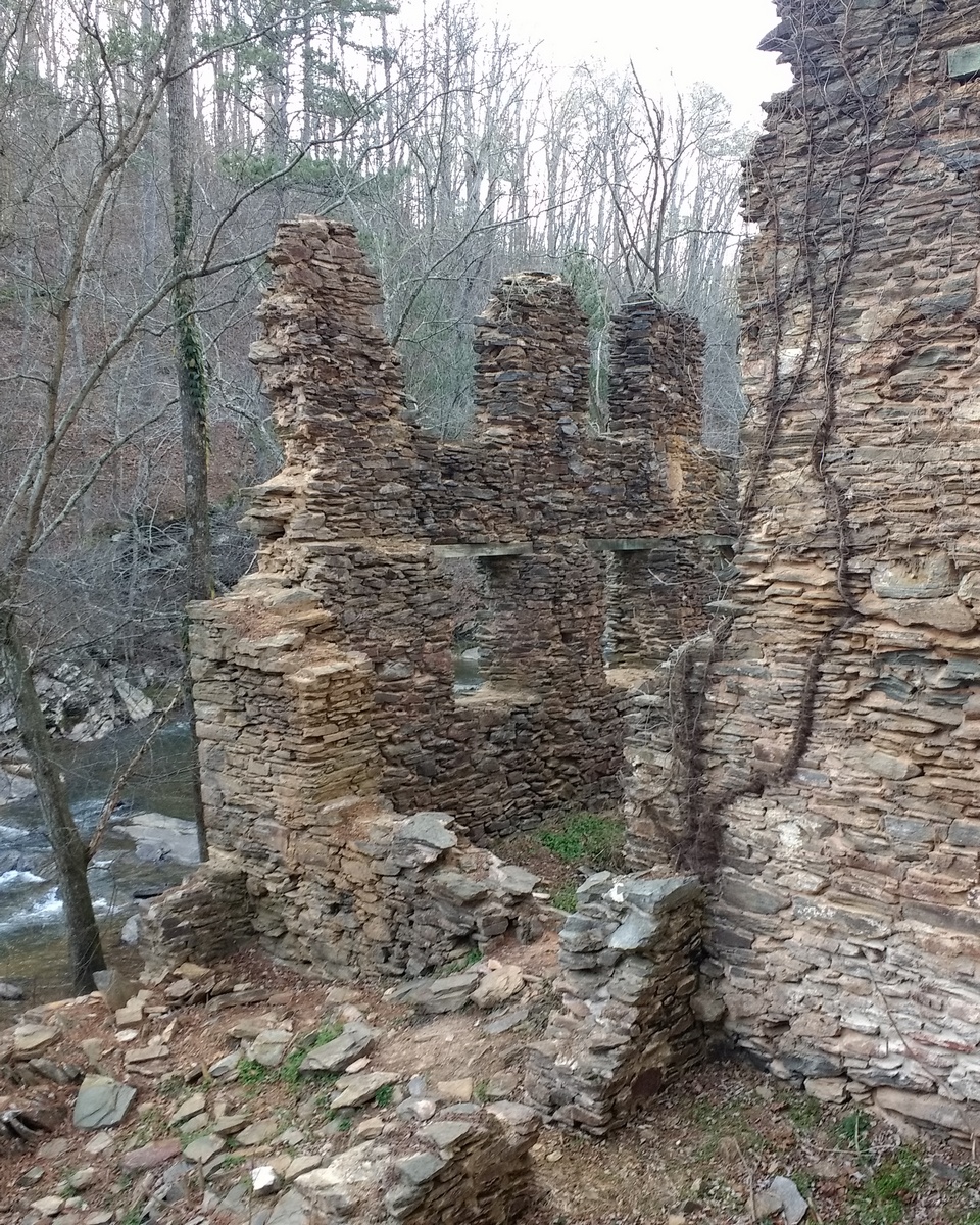
By the 1940’s everything was abandoned. You can see stone supports along the river bank that supported a sluice to carry water to the mill for power. I think the first building we came to on the West bank near the road was a pulp mill and the paper mill was down at the end of the trail along the East bank. After getting to the end of that trail, we walked back and then went on a loop through the woods. Because the sun was getting low, we did a smaller loop than the website we saw had marked out, but still got in close to 3 miles, I think. There were more people than at Arabia and most had dogs. Bella enjoyed getting to see the different dogs and was well behaved with all of them, though not all of the dogs did as well and some people kept their dogs away. It was about a 30-minute drive to get there, so not real environmentally friendly to burn so much gas for exercise, but it was a good trip.
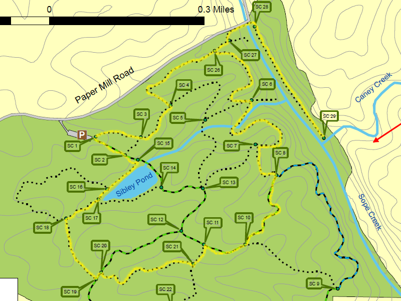
Here’s a map of the area with our route highlighted in yellow (based on the National Park Service map). We started at the parking area, marked P and then went clockwise towards SC3. Each of the SC points (for Sope Creek I guess) is supposed to have a map and is usually at intersection points of trails, so you can plot out your whole hike pretty easily. The dotted trails are for hiking only, but the dashed trails allow bicycles.