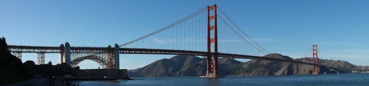
Last year my lunch buddies, Brad and Paul, went up to the far northeast corner of Georgia to find Ellicott’s Rock. This rock was determined to be the three-way border of North Carolina, South Carolina, and Georgia by Andrew Ellicott in 1811. Ellicott was a well-respected surveyor who had already laid out the city of Washington, DC according to L’Enfant’s plans. He was hired by the state of Georgia to correct the location of the Georgia and North Carolina state line 3 miles to the north. Ellicott asked for Georgia to pay for better equipment but they refused. And when Ellicott confirmed the location of the line and kept it in place (he actually missed the correct 35th parallel by about 300 feet to the north), Georgia refused to pay him at all. A couple of years later the three states put together another expedition to settle the issue and another rock, called Commissioners Rock, was chiseled. The area is deep in national forest shared by the three states, in an area now called the Ellicott’s Rock Wilderness. Last year, Paul and Brad were able to find Commissioners Rock, but were unable to find Ellicott’s Rock, which they understood was 500 feet downstream. With more research, they decided that Ellicott’s Rock might be much closer. We decided to go on State Holiday No. 1, formerly known as Confederate Memorial Day. That was yesterday.
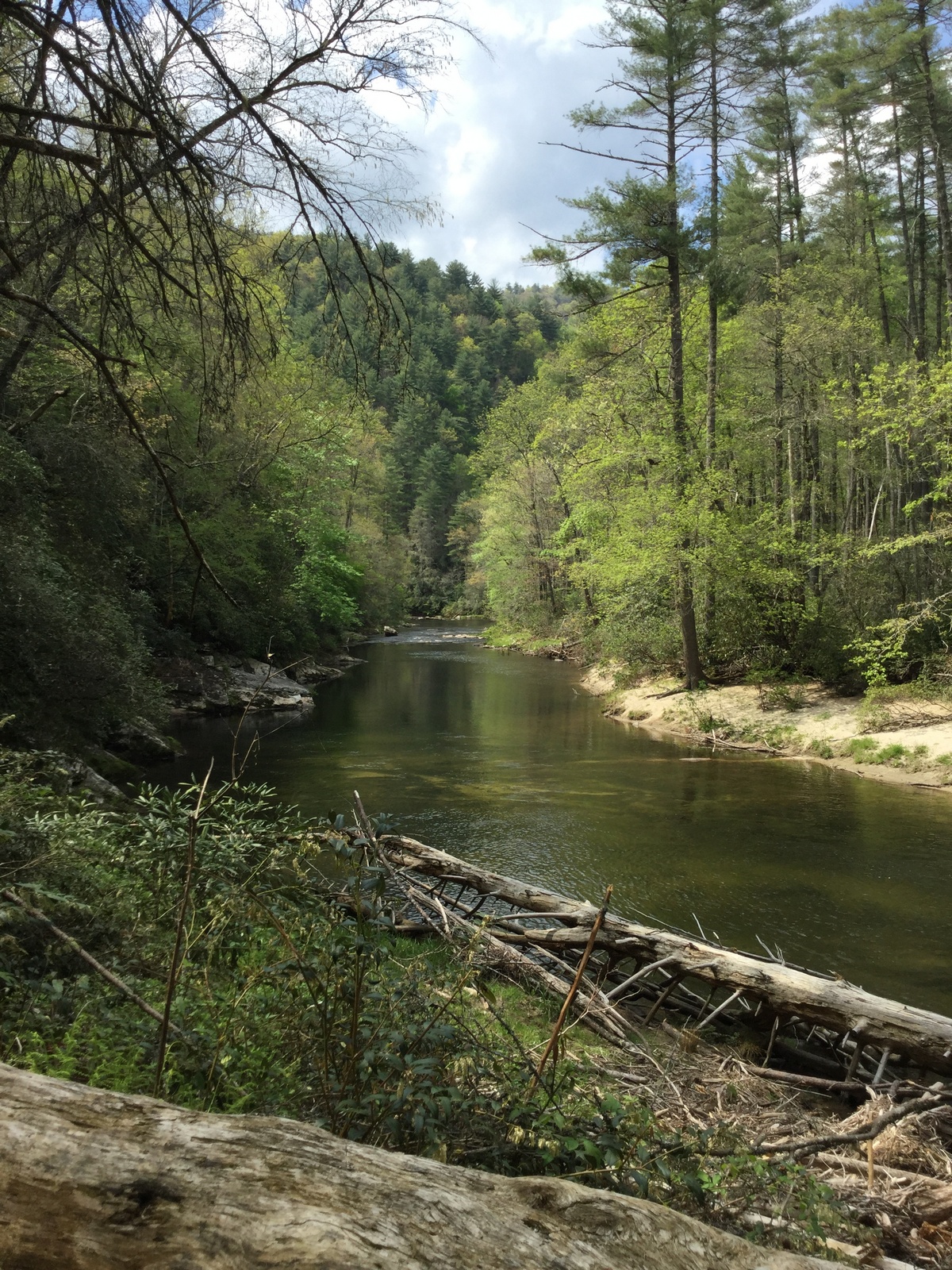

It’s a long drive up there and ends in a very long winding dirt road that runs for 6.8 miles before ending at the trailhead for a 3.4 mile hike along the Chattooga River to Ellicott’s Rock. Even though it was a holiday, I had to get up earlier than usual to get up to Flowery Branch to meet the others and then drive up there, hike, and get out in plenty of time before dark. For such a remote location, the trail is pretty well used. Brad says the remoteness draws more people and keeps it surprisingly crowded. There weren’t any big State Holiday No. 1 crowds, but we probably saw 10 or 12 other people all day, mostly close to the trailhead.
I like hiking and it was perfect weather, before most of the bugs are out, but also while a lot of flowers are blooming. There were also tons of yellow swallowtail butterflies, which Paul was excited to see. But he gets excited to see a lot of things, and is a walking encyclopedia of history, flora, and fauna. So the swallowtails are Georgia’s state butterfly and in some branches, the female yellow swallowtails are actually black. But we saw all yellows, except for one injured black one.
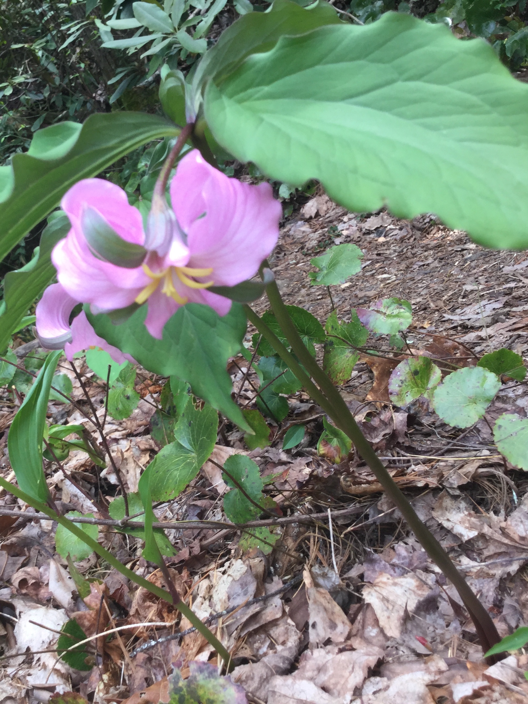
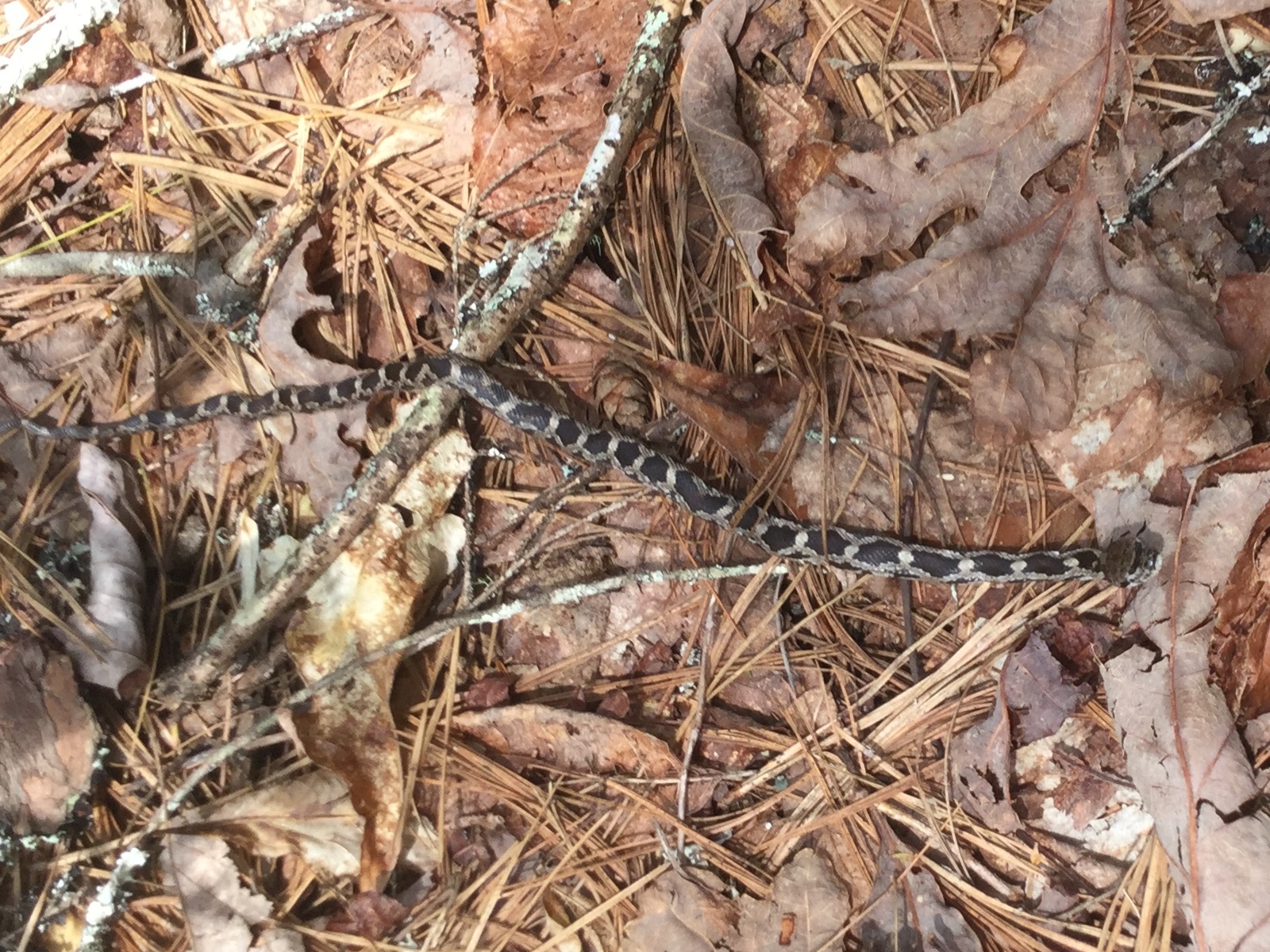
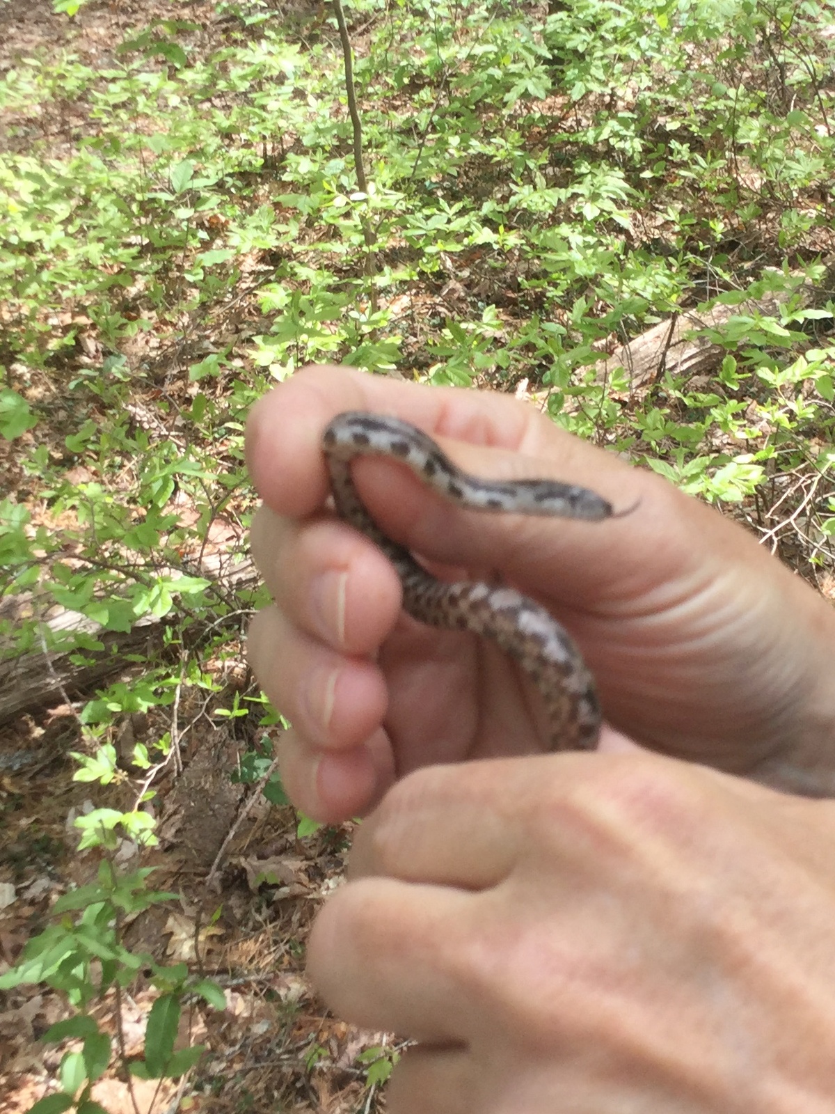
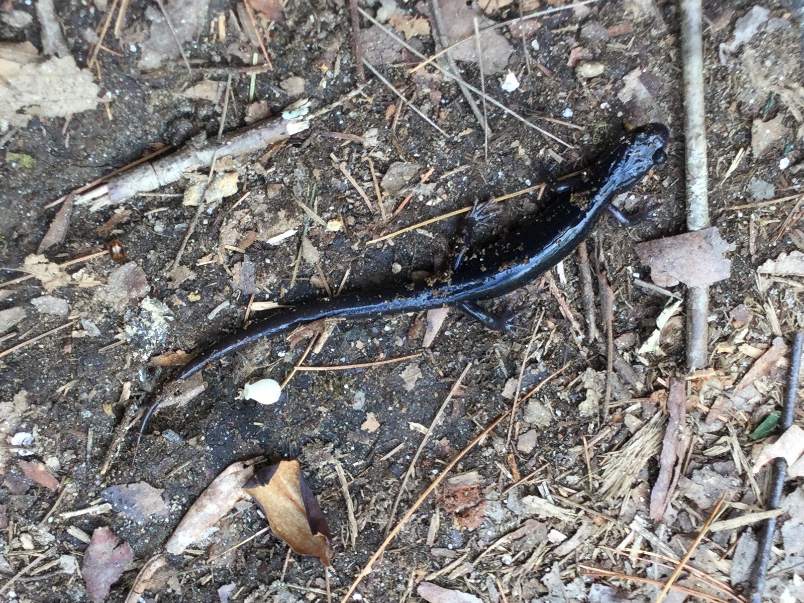
Because the trail runs through forest, but also along the river, there are a lot of neat plants and we even saw some interesting animals along the way. We learned that not all 3-leaved plants are to be avoided, finding a couple of different trilliums in bloom. We saw lots of Catesby Trillium with a single pink flower rising up from or hiding below its three leaves. And I saw one Sweet White Trillium with a white flower and much fatter leaves. Walking behind the other two and keeping my eye on the ground, I found a blue-tailed skink before being corrected that it is a 5-lined skink and that the juveniles have blue tails. They are pretty common, but that was the only one we saw. Later on I saw small snake, which Paul identified as a juvenile black or gray ratsnake. Ratsnakes look a lot alike as juveniles, but they have a distinctive checkerboard belly that Paul had to show us after picking up the snake.


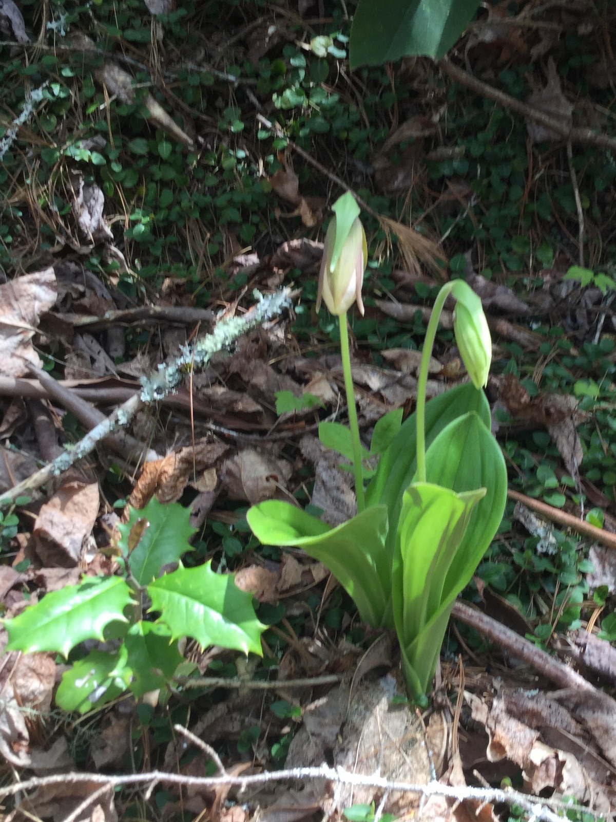
After seeing all the flowers, I wished I had brought a better camera, but all I had was the iPod which does okay, but has a hard time focusing up close (I didn’t bring my macro lens either). A highlight from the previous year’s trip was seeing a pink ladyslipper flower in bloom. Just two of them next to each other. As we got close to that area we looked for them and found them in exactly the same spot, but not yet bloomed this year.
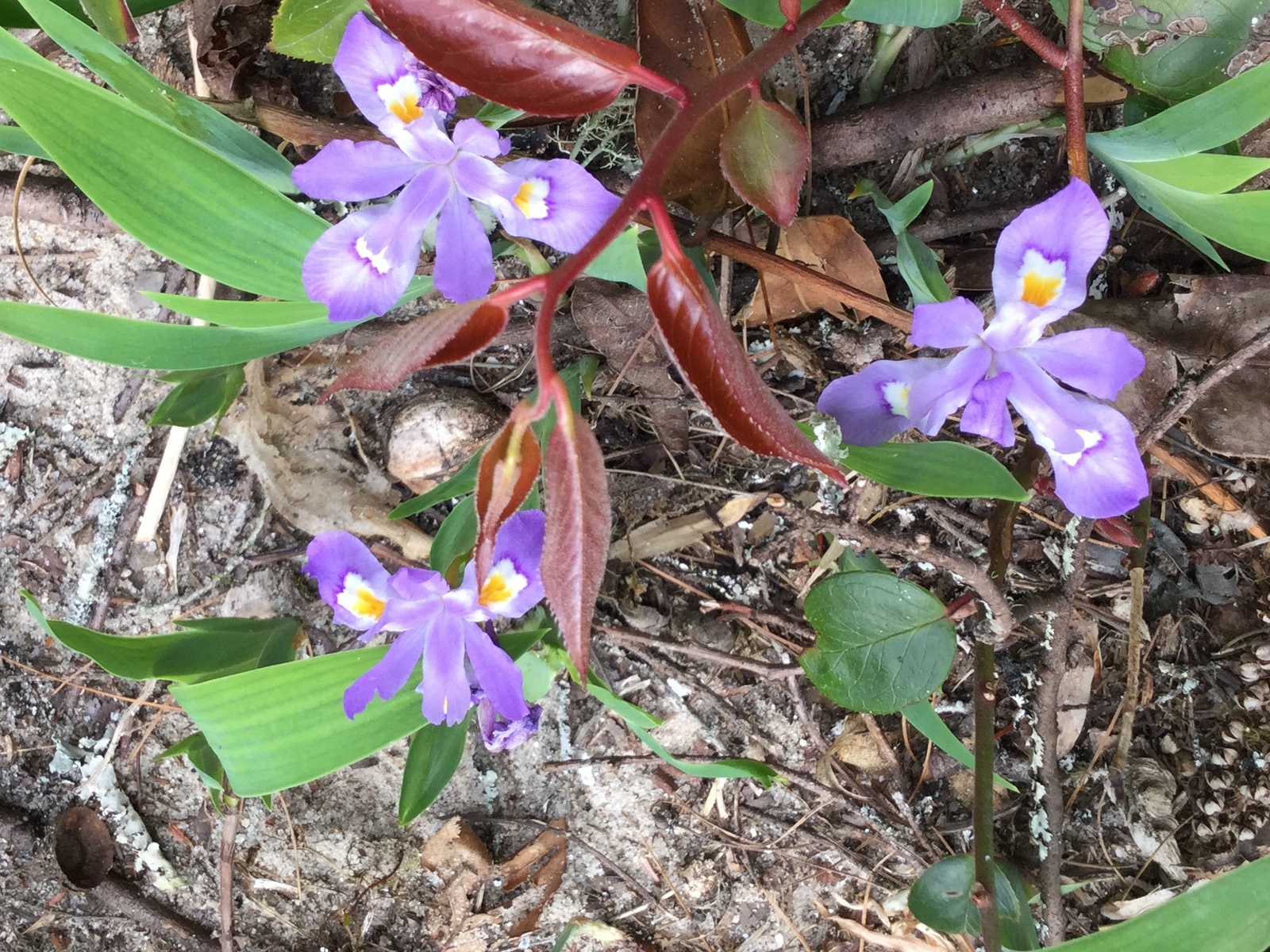
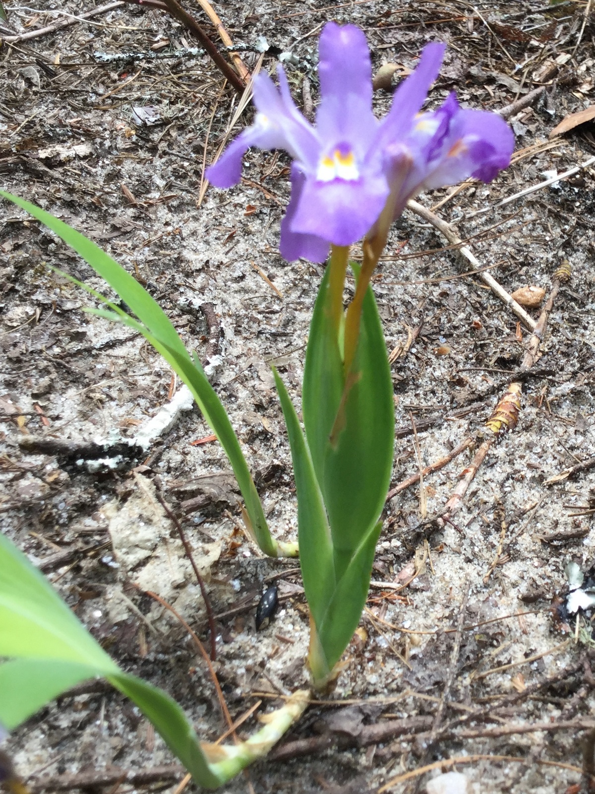
There were some other neat flowers too. A lot of places had tiny little bluets growing along the ground near moss. And at one campsite there were a ton of irises, which I later found out are probably Crested Dwarf Irises.

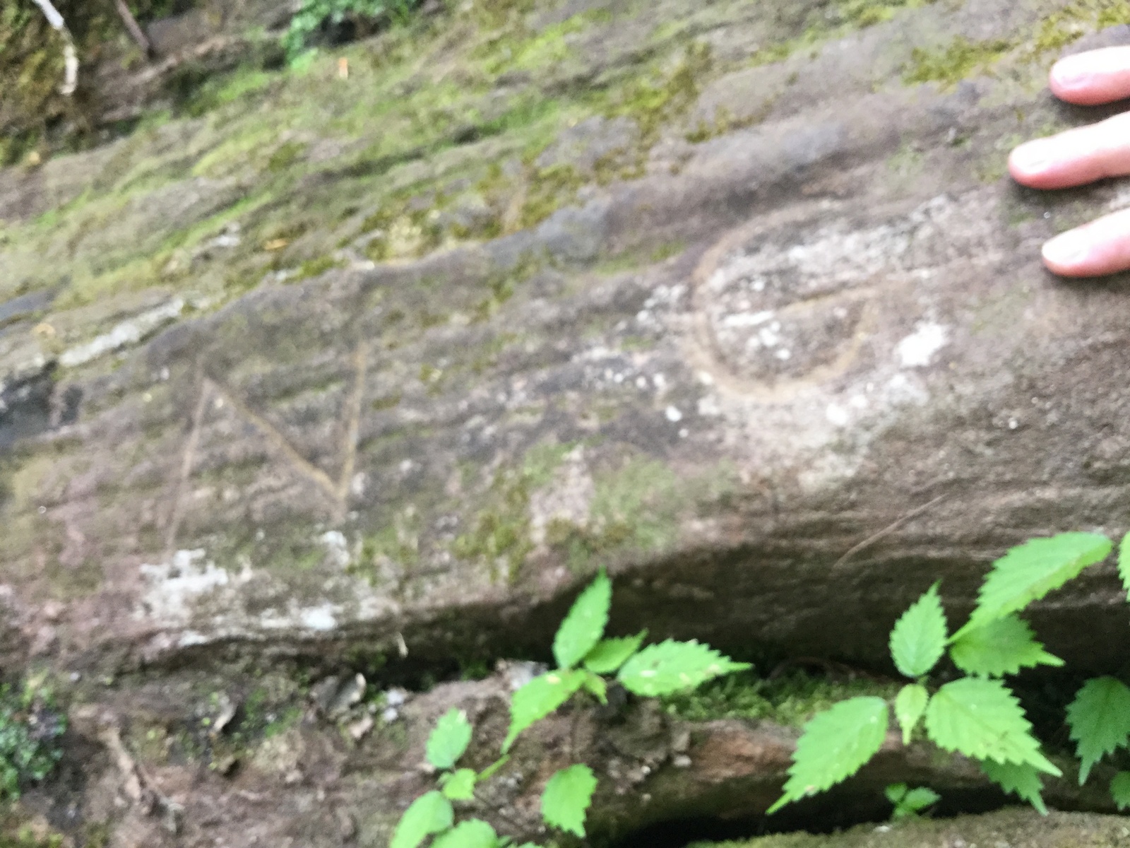
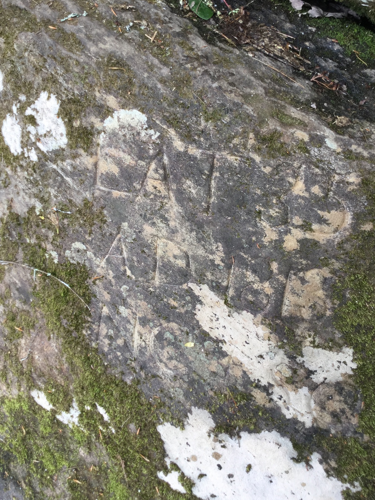
We finally made it to the part where the rock is located and Brad scampered down the river bank and found Commissioners Rock again in no time. As we were admiring that rock, he yelled out and had found Ellicott’s Rock just about 10 or 15 feet upstream, marked simply N-G.
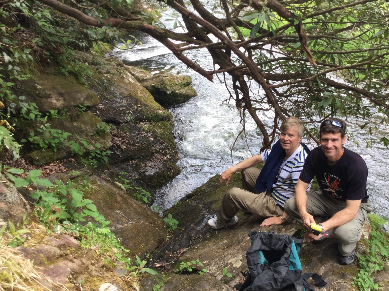
We also stopped by a geocache they had found accidentally the previous year and later on saw some dancing butterflies that I was able to record and a salamander. We got back to the car around 4 PM, earlier than scheduled due to the good fortune of finding the rock so quickly. Anyway, it was a pretty neat trip with surprisingly rich wildlife. The pink ladyslippers should be in bloom soon and not long after that the tons and tons of rhodendron that grow along the trail. So I think it could be worth revisiting at other times except that it’s kind of hard to get to (you can cut the dirt road driving in about half if you come from the South Carolina side).

Hi – Great Blog with great pictures and descriptions of flowers etc. We are trying to find Ellicott’s Rock. Here is a link to my RWGPS
https://ridewithgps.com/trips/17742437#
Track. We did not find the rock and are determined to try again this week. I’m sure we were close but we did not find any clues or signs along the Chattooga River Trail pointing to point along the river. Do you remember anything distinctive that we should look for on the trail that will help us locate the rock. Would you happen to have a GPS track for your hike that you can send us? Congratulations on your success and thanks for any assistance you can offer. Pete Tintle
I didn’t have GPS, but my friends might have it and I will update this reply. They had been there before and found the right place to scramble down the riverbank to get to the rock. You could tell other people had gone down there too. It seems like it was maybe a couple of hundred feet south of the end of the trail. [Peter wrote to me separately and said he was able to find the rock. There is a nail in a tree marking the point where you leave the trail, but as the tree has grown it has gotten a little higher than you might normally look.]